The project brief was to refine and develop a robust masterplan for a new community that will eventually provide over 1200 homes alongside a harbour-side town centre. The expectation was for it to be included as a new growth area in the Whangarei District Plan.
Challenges Opportunities
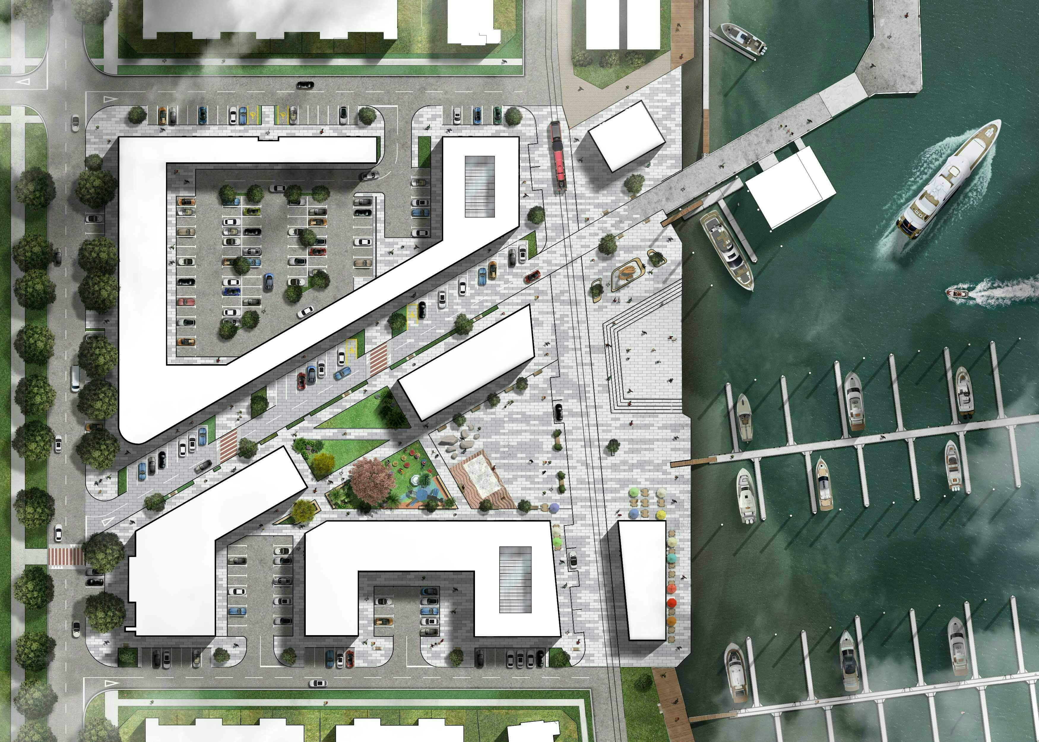
Covering 67ha of former port land on Whangarei Harbour, the site presented a flat canvas that was bounded by industrial buildings and the shoreline. The key challenge was to introduce intensification into a city that has traditionally been populated with low density lots, and to plan place-based built fabric that will attract an active and diverse community. To achieve this, it was fundamental to leverage the unique features of the site that included access and views to the Mangapai River, and proximity to the marina.
Solution
Beginning the process with a conceptual layout, the masterplan was developed to create a connected and legible neighbourhood that offers a variety of amenities. It includes a grid street network, town centre, low and medium density residential housing, retirement housing, mixed use buildings, and public open space. Two key elements define the masterplan: Waitai Trail and Arataki Avenue. The former, offers a safe and engaging route for pedestrians and cyclists that weaves between the coastal edge, mangroves, parkland, and urban areas. Arataki Avenue on the alignment of the historic Tide Gauge Wharf forms a major axis through the development that provides a pedestrian and cycle friendly route for residents to reach the shoreline or village centre. The outcome is a walkable coastal community that projects a sense of place.
Port Nikau Masterplan
- Project Masterplanning
- Status In Progress
- Location Port Nikau, Whangarei


Project info
Client
Port Nikau Joint Venture
Year
2018-Current
Location
Port Nikau, Whangarei
Team
Related projects